Nature's Treatment: Statement
Humans attempt to stabilize landscapes. They line coastlines with wave-dissipating blocks, install concrete lattices on hillsides, and dam rivers. Slope protection frameworks, river revetments, erosion control weirs—each of these structures constitutes an intervention applied to failing terrain. Nature's Treatment is a project that reframes such civil engineering interventions as medical acts—as forms of treatment—and documents their progress through photography.
Treatment is always accompanied by uncertainty. At the moment of intervention, we cannot know whether it is correct. Its effectiveness is confirmed only years, or decades, later—and sometimes even that assessment is overturned. Treatment is nothing other than the act of making choices without knowing their outcomes.
Two experiences underlie this project.
In early childhood, I suffered from Kawasaki disease—an acute febrile vasculitis of unknown origin that remains unexplained more than half a century after its discovery. Because my symptoms were clearly manifested, I was photographed and recorded as a case sample. I became part of a medical chart. The accumulation of such patient records eventually led to the establishment of treatment methods that minimize aftereffects, even without understanding the cause. But when I was treated, that knowledge did not yet exist, and I was left with lasting effects. I continue to be monitored through regular checkups.
The second experience was my father's stroke. At the hospital where he was taken, a different diagnosis was given. Suspecting a stroke based on his condition, I decided to transfer him to another hospital. My father survived. But what I want to convey here is not a narrative of "my judgment was correct." I still cannot rule out the possibility that a different choice might have led to a different outcome. Choices are irreversible, and the appropriateness of an intervention can only be assessed in retrospect.
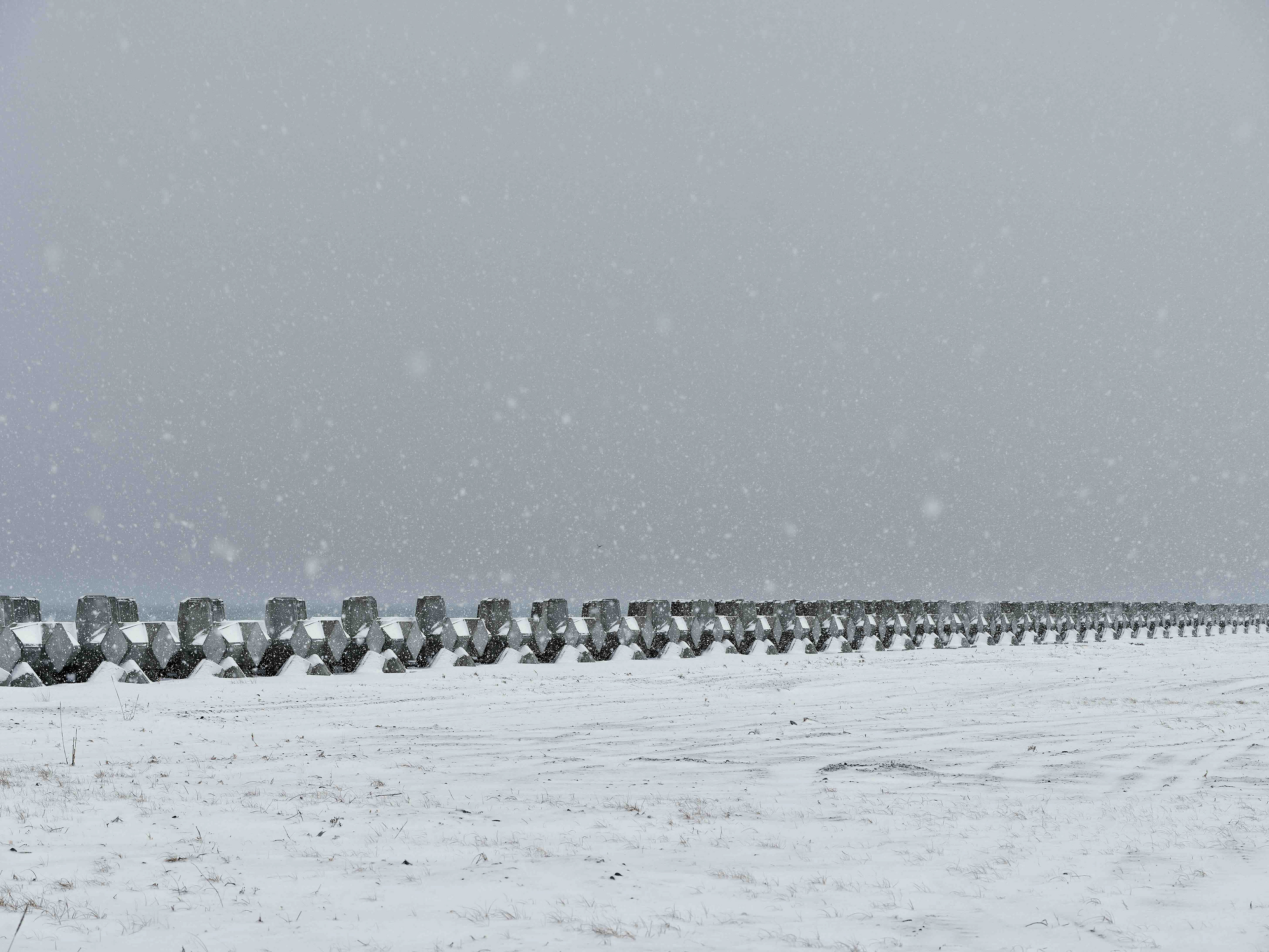
When I saw the rows of wave-dissipating blocks on the Notsuke Peninsula, I recognized the same structure. There is something to protect, a line is drawn, an attempt is made to fix it in place. But whether that intervention was correct cannot be known at this moment. Assessment always arrives late.
I was once on the side of being recorded in a medical chart. Now I photograph from the side that creates charts. Each photograph is a progress record of treatment applied to the land. I do not judge the rightness or wrongness of intervention. I simply observe and document moments when human boundary-drawing cannot keep pace with the speed of nature. The record exists as material for someone in the future to render judgment. Just as the record of my Kawasaki disease changed the treatment of later patients, this record of landscape, too, is left for an evaluation not yet visible.
Notuke Peninsula
Notsuke Peninsula is a sand spit shaped by currents—an edge that keeps changing. Wind, waves, freezing and thawing continually redraw its outline. People have tried to stabilize this unstable place: revetments and wave-dissipating blocks are laid along the shore; roads, pipes, and lines are imposed to hold a boundary in place.
野付半島は、潮流が運ぶ砂によって形を変え続ける岬である。風と波、凍結と融解が境界を削り、地形の輪郭は固定されない。人はそこに線を引き、護岸や消波ブロックを置き、道や配管を通して、この岬を“安定”させようとしてきた。
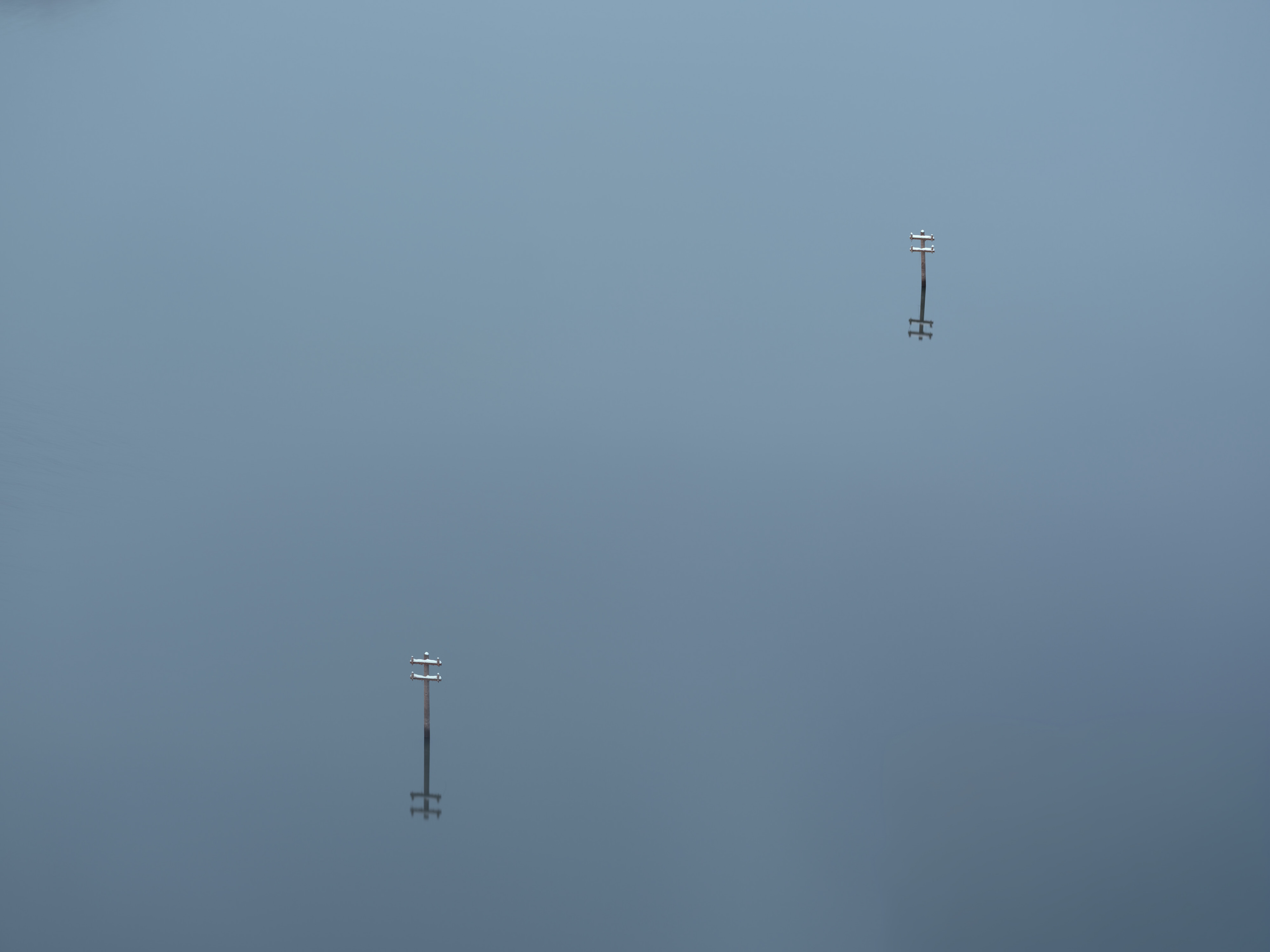
Waterline Chart
Tsukui Lake (Shiroyama Dam) and Miyagase Lake (Miyagase Dam) are valleys inundated by dams built for flood control. Traces of everyday life—including the Arakawa and Nakazawa settlements—have been preserved beneath the water’s surface for more than half a century.
In February 2026, a severe drought—the first in decades—caused Tsukui Lake’s water level to drop sharply. Foundations of a shrine, stonework from a well, and stumps with exposed roots emerged from the lakebed.
津久井湖(城山ダム)と宮ヶ瀬湖(宮ヶ瀬ダム)は、治水のために築かれたダムが水没させた谷間である。荒川集落、中沢集落をはじめとする生活の痕跡は、半世紀以上にわたって水面の下に保存されてきた。
2026年2月、数十年ぶりの渇水により津久井湖の水位が大きく下がった。神社の基礎、井戸の石組み、根を剥き出しにした切り株が湖底から現れた。
2026年2月、数十年ぶりの渇水により津久井湖の水位が大きく下がった。神社の基礎、井戸の石組み、根を剥き出しにした切り株が湖底から現れた。